Widespread Severe Threat Including Strong Tornadoes, Hail, High Winds Ahead For Midwest, South, East
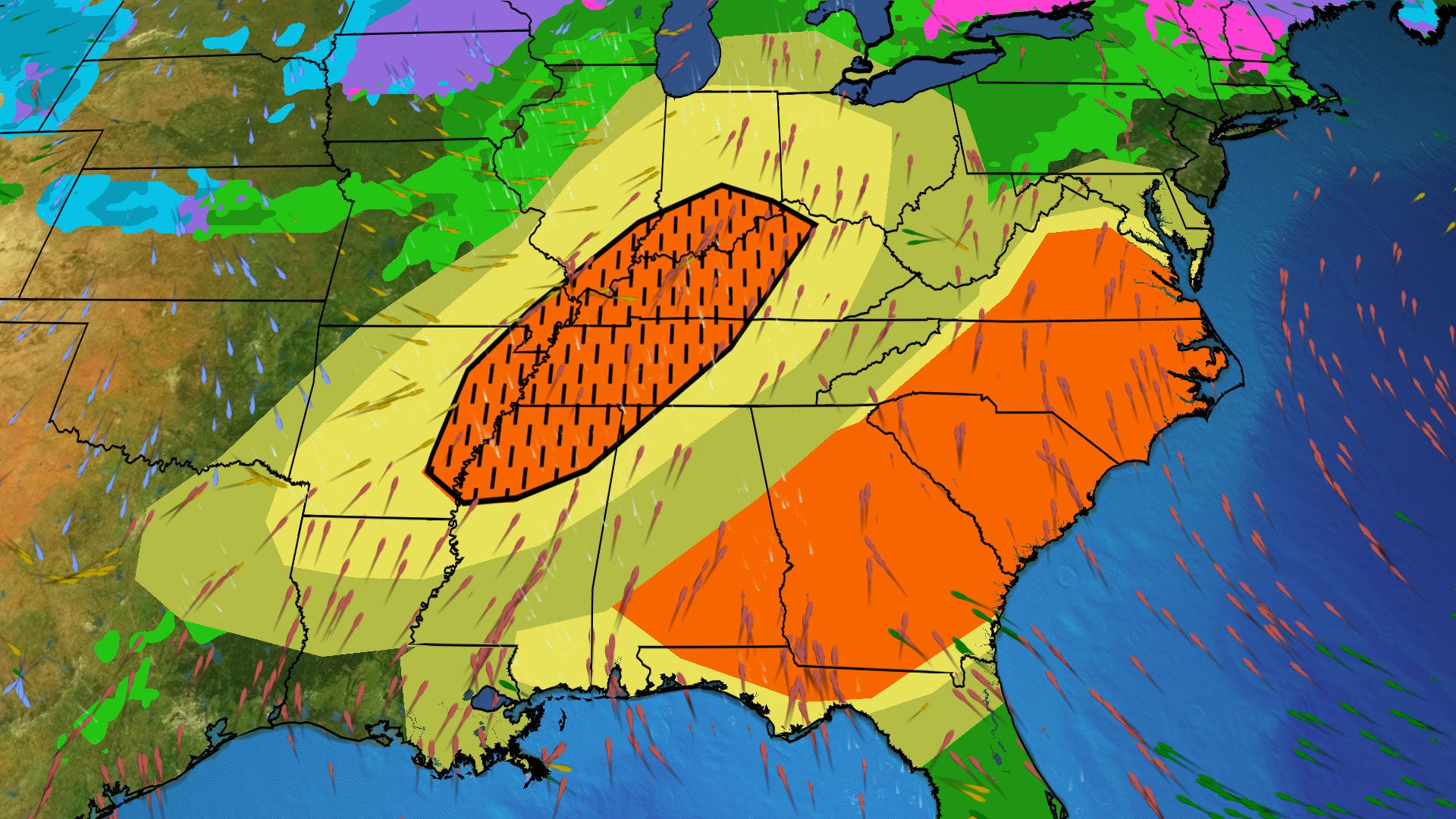
A widespread threat of severe thunderstorms will develop Sunday into Monday across the Midwest, South, and extending to the East Coast as March comes to an end.
Dangerous Severe Threat Grows
This severe weather risk mirrors the areas affected by a major outbreak two weeks ago.
Timing and Expected Impact
The storm system is already producing some thunderstorm activity, but it will intensify throughout the day. So far, wind gusts have reached 85 mph in Baxter Springs, Kansas, causing damage with reported debris, while Joplin, Missouri, recorded gusts of 79 mph. Hail measuring up to 2.5 inches was observed near Bridge Creek and Amber, Oklahoma.
Current Radar and Storm Movement
Currently, thunderstorms are highlighted in the radar. The storm is expected to intensify from eastern Texas through the southern Great Lakes, impacting the Mississippi, Ohio, and Tennessee valleys with severe storms from Sunday afternoon into the night.
Additional Weather Updates
Winds, hail, and tornadoes of EF2 strength and above are expected in areas like Indianapolis, Indiana; Little Rock, Arkansas; Louisville, Kentucky; and parts of Tennessee. The thunderstorm activity may translate into a line of severe storms late Sunday evening into early Monday morning, drastically increasing the risk of damaging winds.
Monday’s Forecast
Severe weather is anticipated ahead of a cold front sweeping through from the Gulf Coast into the Southeast, mid-Atlantic, and Northeast regions, affecting places like Atlanta, Georgia; Charlotte; and Washington, D.C. Predominantly, wind damage will be a key concern, although some locations may also experience large hail and tornado threats extending from southern Alabama to Virginia.
A Springtime Setup for Hazards
The ongoing severe weather threat is a typical pattern for March as a steep jet stream swoops southward, coupled with a strong low-pressure system that will bring moisture from the Gulf of Mexico.
Residents are urged to stay informed and prepared for severe weather as conditions evolve over the coming days.


